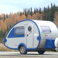
My vehicle and T@b trailer

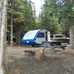
For a few years, I have been dreaming of traveling after retirement.  In April 2016, my home sold.   I was planning to buy a camping trailer and would need a new vehicle suitable for towing one.  So within a matter of 2 weeks, I found a 2012 Toyota RAV4 V6 to buy.   Then I bought a 2016 T@b Max S.

Here it is:
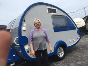
I had a while ago decided that a motorhome would not be good for what I wanted to do, since I would not want to have to tow a car also.   I wanted something small enough that I could handle.   I wanted an inside bathroom.  I couldn’t imagine tromping to a campground bathhouse in the middle of the night!!  So  I looked online at Scamps, Casitas, A-liners, lilsnoozy  and others.   The year before, I had stopped to look at T@b teardrop trailers at a dealer and was really impressed with the quality.

So I was real happy to find my T@b  at a discounted price no less.   I quickly found that because of it’s small size, it was light enough to move around by the handles on the front edges.   I learned to hitch up and unhitch and to hook up the electricity, water and sewer.  Backing up into sites took a bit longer, and once I got on the road, I found some spots were more challenging.   At first I would request pull-through sites where no backing up was necessary.   But some more remote places had no pull-throughs, and some spots were wierd shapes or didn’t have much maneuvering space on the road to even back up good.   So I quickly had to learn to do what was needed.
September 26th – Leaving Canada – Hope BC to Seattle

Today I had a very short journey as I was only going as far as Seattle to visit a childhood friend.   The journey took approximately 3 hours and was 264 kilometers=164 miles.

I took my time getting up in the morning, knowing I didn’t have to be in a hurry with a short journey ahead.   I also knew I would be closer to “civilization” haha than I had been in a weeks, so I was planning to stop and have a leisurely lunch somewhere and find a Walmart or Target to do some shopping.

I crossed from Canada back into the US at the Sumas – Huntingdon crossing south of Abbottsford.  I drove to Seattle area, where I got off an exit of Highway I-5 South to have lunch and do some shopping.   After being on the remote roads of Canada and Alaska, the traffic around Seattle was intimidating!

By the way, what do I do with my dog and cat while I am eating and shopping??   Well, I could never leave them in either a car or the T@b in hot weather, but it was pleasantly cool, so I put them both in the parked camper,  opened the fan cover on the top for some circulation inside and they were comfy and happy while I was gone for an hour or so.

The next day will be visiting with a childhood friend!!!


September 25th – Cariboo District – Quesnel BC to Hope BC

Today was a relatively short day.   I traveled only 6 hours, 510 kilometers=317 miles.

For the first time in almost 2 months, the daytime temperature reached 77.  My journey today took me through what is called the Cariboo District.

https://en.wikipedia.org/wiki/Cariboo

 I don’t know what this was, but it was everywhere, and for some reason looked fascinating to me!

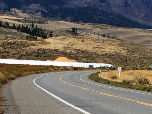
These  white “pillows” are hay bales covered with plastic.   I called them “BC Marshmellows”!

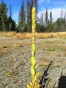
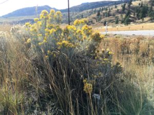
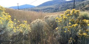
These gold and white weeds were all over the sides of the highway.   They looked like broccoli and cauliflower!

I stayed overnight at the Hope Valley Campground.

http://hopevalleyrv.ca/index.html

Remember that the heat had quit working in the T@b?  It wasn’t as cold tonight, so I and Burrito and Oreo felt just fine without it.   The camp site was a beautiful wooded one.   I warmed up some chili for supper.


September 24th – Charlie Lake to Quesnel B.C.

Today I traveled about 6  1/2 hours, 562 kilometers = 349 miles.

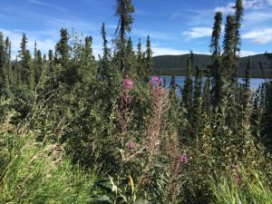
You might notice that I did not mention visiting the big cities of Haines, Whitehorse, Ft. Nelson, Dawson Creek, Prince George   etc.    I am NOT a fan of cities, even relatively smaller ones and would much rather spend my time basking in the scenery and wildlife of the more remote areas.  So I just sailed right past those cities and made stops for scenery at the many pull-outs, rest stops, etc.   You know, time to stop and smell the roses!  Or the frozen fireweed, I should say!

Slightly over an hour after leaving Charlie Lake this morning, I finally reached Mile 0 on the Alaska Highway, which is at Dawson Creek.

http://www.hellobc.com/dawson-creek.aspx

I then turned southwest on highway 97, aiming for Prince George.   [On my journey up to Alaska in August going the other way, I had turned west at Prince George towards Kitwanga and the Cassiar Highway.]   So going this way on the return journey gave me a different route and enabled me to complete the Alaska Highway journey in reverse.   The Cassiar Highway is also much more remote and less traveled at this time of year, which was a consideration for me.

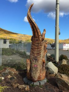
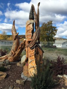
About an hour southwest of Dawson Creek on Hwy 97 is Chetwynd.   It is a must-stop.   At least drive around and look.  It is known for the many carved statues that are EVERYWHERE around the town.

http://www.discoverthepeacecountry.com/htmlpages/chetwynd.html


Lunch time was in Prince George, then on down the road.   No cities for me!

When I arrived this evening in Quesnel, I experienced the second (or maybe it was third, I’ve lost track) hiccup of the trip.   It was very cold and I could not get the heat to work in my T@b.  After walking to a place to eat, coming back and still not able to make it work and being very cold, I decided to pull up and go to a hotel for the night.  There was one nearby that allowed pets too, so we pulled into the parking lot, went inside and got a room.   What a change to sleep in a regular bed, take a bath in a bathtub and do some laundry down the hallway!   Burrito and Oreo seemed to enjoy having more room to roam in the room and we all enjoyed a different kind of night.   I could worry about getting the heat fixed later.  [When I got home, I took my T@b trailer in to Holiday World of Dallas for service.  They diagnosed the problem with the heat as a blown fuse.   Now I know.  I had spare fuses for the inverter box, but not for that, and wouldn’t have even known where to check that particular fuse as it is underneath the bench where the Alde heater is.]

September 23 – Toad River to Charlie Lake near Ft. John

Today I traveled a little over 6 hours, 556 kms or 345 miles.

A beautiful sunrise, then I crossed Summit Pass and the Tetsa River and Steamboat Mountain.

I saw 2 elk and lots of sheep and horse farms after Ft. Nelson.  This area is big for natural gas exploration, so truck traffic was heavy and many natural gas pipelines and stacks with flares can be seen from Sikanni to Pink Mountain.

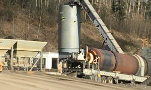
  I don’t know what this was,

but the horizontal cylinder had some wicked glowing fire in it.

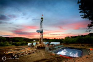
   This is an internet steal photo,
since I couldn’t get close to take a picture of a gas well.

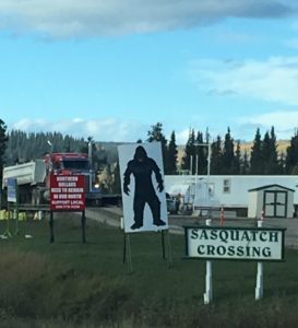
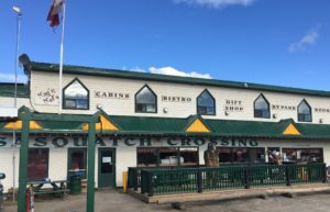
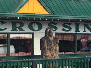
In case you wondered where Sasquatch is, he is alive and well, or should I say statuesque and wooden at Pink Mountain, British Colombia, Mile 147 of the Alaska Highway!

http://www.campgroundsalaska.com/alaskahighway/sasquatch-crossing-alaska-highway.php

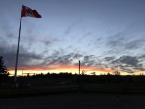
I stayed overnight in Charlie Lake at the Ross H Maclean Rotary RV Park.  It was going to close at the end of the month, so it was almost empty.  The sites have no trees, but it is all fenced in next to a nature preserve and park.   It has very clean laundry facilities etc.  The sunset here was gorgeous.

Note:  the website link that comes up when you google this park does not work.    The park is only about 10 miles west of Ft. St. John, so very convenient to get gas, groceries etc.

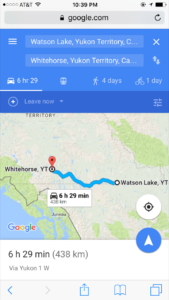
August 12th – Watson Lake to Whitehorse

I didn’t make very good time on the Cassiar because of rough roads.   Now that I am on the Alaska Highway (also called the Alcan), it’s not much better.  There are many construction areas, causing delays of 30 minutes to an hour.  6  1/2  hours became more like 8.   Especially with restroom breaks and picture stops.   But this is not a race and I have no real schedule, so no worries!

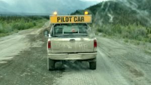
Construction zones involve waiting till a pilot car can guide the line of vehicles through a spot  where they are working:

I left early in the morning and arrived before dark at the Caribou RV Park,  https://www.caribou-rv-park.com/  which is 22 miles east of Whitehorse.   I wish I had picked a place closer to town, but the setting was more woodsy and quiet.  The ones I saw later closer to town would’ve been like parking lots and noisy.

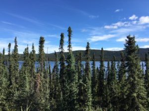
Rest-stop beauties:

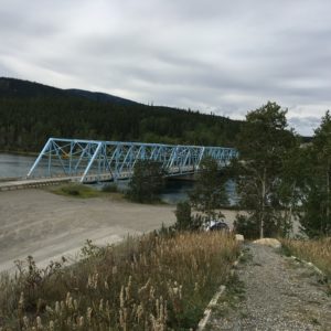
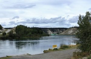
Marsh Lake and Dam:

I got in early in the afternoon, so had time enough to drive into Whitehorse, get an oil change and shopped for more groceries.  [Just as my nephew predicted, I was in the middle of the Yukon when I needed another oil change!]

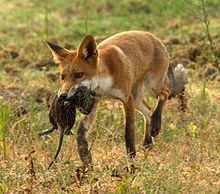
There is a restaurant next door called the Wolfs Den.   http://www.wolfsden.ca/  While eating supper on the outside deck there, a fox walked right up!

Kinda hard to tell, but the fox is right in the middle to the right of the vehicles.  I wish I had gotten a better picture.  So I’ll borrow a pic from the internet.   He looked like this:


August 11th – To Watson Lake

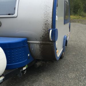
Kinaskan Lake was about halfway to Watson Lake.  It was raining off and on all day long, making the rough roads even nastier.  My vehicle and camper began to get very muddy!  I even saw a lake along the way called “Mud Lake”!

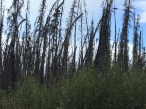
North and south of Wheeler Lake are miles and miles of burnt trees from a forest fire.   I will have to find out when that was.

^It actually looked worse than this.  This pic was taken early on in the mud-slinging!

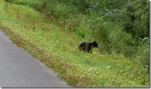
About a miles south of Taft Creek bridge, I saw a baby black bear!  It skeedaddled into the woods at the side of the road when I drove up, so I didn’t get a good picture of it, but it looked like this:

About halfway to Watson Lake, there is a place called Jade City.   It has gas and a souvenir store full of jade objects to buy.  http://jadecity.com/

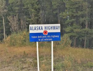
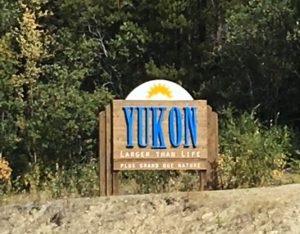
I finally reached the Yukon and the Alaska Highway!!!

Tonight I stayed at the Baby Nugget RV Park, which is at mile 650 of the Alaska Highway just a 1/2 mile west of where the Cassiar (Hwy 37) runs into it.    http://nuggetcity.com/baby-nugget-rv-park/

The RV Park is very bare; very few trees, but it has a restaurant that is very reasonable next door, a car/rv wash, laundry, nice bathroom/shower facilities, full hookups  and a gas station. It’s just a cold, bare landscape though.  Since it had been days  of “roughing it”, I treated myself to supper at the restaurant.    I also treated my car and T@b to a shower at the car/rv wash!  Wanna guess how long it took to get dirty again?!

Because of the rough roads and rain, what should’ve been a 5  1/2 hr drive turned into about 8 hours.   It was 385 kilometers = 240 miles.   So less mileage than other days, but took way longer!


August 10th Traveling the Cassiar Highway

It was a beautiful morning as I left Houston BC.

I had my first problem of the day after turning onto the Cassiar Highway at Kitwanga.

About 30 minutes after getting onto the Cassiar, my check engine light went on and “Auto LSD” red light flashing.   I had no idea what was going on.   There was no cell coverage and the Cassiar is quite remote and devoid of services.  So I turned around, went back to Kitwanga where I finally got cell phone signal!   I called my brother in TX who owns an auto shop.   He advised me that it was probably nothing, maybe a loose sensor,  and to continue.  The road is REAL rough and dusty, so a loose sensor was plausible, and everything was running well.    There is no mechanic available in Kitwanga either, so nobody else to look at it.

Then came the second problem.  I came around a curve in the road and there was a bunch of rocks fallen in road.  I avoided them with my vehicle, but the camper hit one.  BANG!  Shaken, I stopped and took a look, and it had hit the step underneath the door, jamming it so that it would no longer fold down.  No other damage though.   [It was later fixed when I got to Prince George.  A mechanic used crowbars and hammers to get the step back in place.] 

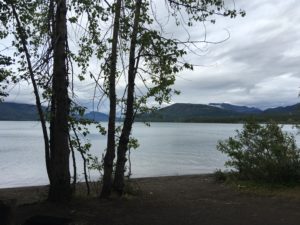
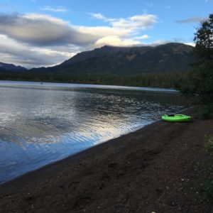
I had thought I might make it to Mt. Shadow RV Park, but the roughness of the road had worn me out, so when I saw Kinaskan Lake Provincial Park come up, I pulled in.  http://www.env.gov.bc.ca/bcparks/explore/parkpgs/kinaskan_lk/             It ended up being one of the most remote, rustic parks of the whole trip, but the most beautiful setting.   There are NO SERVICES there; no hookups of any sort.  One pump for water in the park and a couple of outhouses.  BUT my site was right in the trees and steps from the lake.  There were kayakers on the lake and one small johnny boat with a tiny engine, but otherwise peaceful.   I took a hike around the lake, made supper and then snuggled up inside with Burrito and Oreo.   It was cold outside and by morning was freezing.

Today I traveled about 7 1/2 hours on Hwy 16W, then 37N (Cassiar); 534 kilometers = 332 miles.

August 9th – On my way to the Cassiar Highway.

Today I was aiming for Hazelton, but only got as far as Houston, B.C.   I was just tired of driving.      I traveled about 6 1/2 hrs via the Yellowhead Highway (16W), 592 kilometers=368 miles.   So when I saw the Shady Rest RV Park and it looked very pretty, I pulled in!   It turned out to be a restful relaxing place. http://www.rvparkreviews.com/regions/british-columbia/houston/shady-rest-rv-park

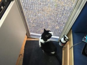
Even my cat Oreo like the campground!   From the screen door.   I loved that the campground bathhouse had individual little rooms with a toilet, shower and sink accessible to outside instead of big huge “gang” bathrooms that feel less private.   It was like having your own bathroom at home!

August 8th – Banff & Jasper National Parks

Both Banff & Jasper are very close proximity to each other, so for time’s sake, I am going to drive through both in one day.   Not planning to do any hikes and will just stop at Lake Louise and the Icefields.   It’s doable because there is so much to see just driving through.

[One thing I’ve had to consider on my trip is safety as a single traveling by myself.   For safety, I don’t feel comfortable doing any solo hikes in remote places.  In well-traveled, well-populated places such as the Hidden Lake trail at Logans Pass in Glacier, it is easy to hike because there are many others around.   But many other places nobody else was around.  So although there were a number of places where I saw trails along the way that could’ve been hiked, I just stuck to the roads for the most part.]

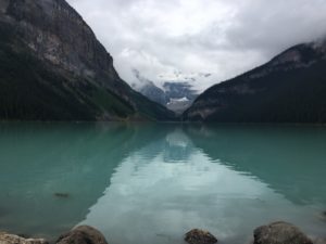
Lake Louise:

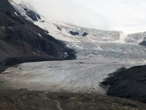
Columbia Icefield:

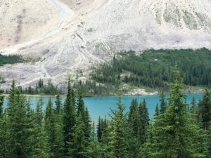
Bow Lake:

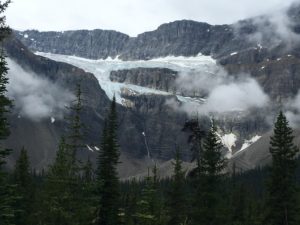
Crowfoot Glacier:

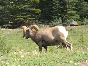
Bighorn sheep at northern end of Jasper:

Tonight I stayed at Mt. Robson Provincial Park, Robson River Campground just east of Tete Jaune Cache.   http://www.env.gov.bc.ca/bcparks/explore/parkpgs/mt_robson/